I'm a little put out about this. I worked for the last two days on the ride report only to lose it when I thought I had saved it and google maps won't show the route I laid out on it.
So here's an abbreviated version.
I was so anxious to get on the road I started out a ten days before the get together. I left L.A. behind and rode to my sisters house just south of Yosemite Park where I spent the first night. She insisted on sending me off with a good breakfast so I was well fortified for the ride Up Hwy 49 to Angels Camp and Hwy 4 over Ebbitts pass through the Sierra Nevada Range and down the east face to Hwy 89 north along the west side of lake Tahoe. 89 runs along at about 6000 ft on the east side of the High Sierras. I found a nice campground just a couple miles south of Truckee on the bank of the Truckee river so I spent the second night there.
Wednesday I packed my gear and continued up 89 to Hwy 36 at Lake Almanor where I turned west and followed it to where 89 runs through Lassen Volcanic National Park. I just had to ride through the park. But even though there was gas in the park near the north exit, they only had regular and I still had more than a gallon in the tank so I rode into Redding on 44 to fill up.
Here the first adventure really started.
Looking at my map I figured I could take a secondary road south to 36 and a camp ground I had passed just before the turn to Lassen.
No big deal, right? Except I missed a turn and ten miles down the road the Pavement ran out. Never one to worry about a little riding off the main roads I went ahead and figured it would eventually run into the road I wanted. Now, In that area these are well packed dirt/gravel logging roads and they run everywhere in the forested area. Do you have any Idea how hard it is to guess directions at mid day in tall trees?
Eventually I found the hwy again and made my way to the campground, set up my tent and had a good nights rest.
Fooled around with Coffee and made some Mountain House Freeze Dried Eggs and Ham for breakfast.
A bit of info for those that might be interested, Freezed Dried eggs are not the same as powdered eggs. I had my share of powdered eggs and they always cook up nice and smooth even if the aren't the best tasting. These Freeze dried eggs cook up to have a grainy mouth feel even though they tasted better than most powdered eggs. It was off putting so I won't be buying anymore of them.
After breakfast I packed up my camp and put it all back on the bike and tied down, taking my time because I had agreed to meat a friend in Red Bluff so we could ride together for a ways seeing how we were both going to the same place.
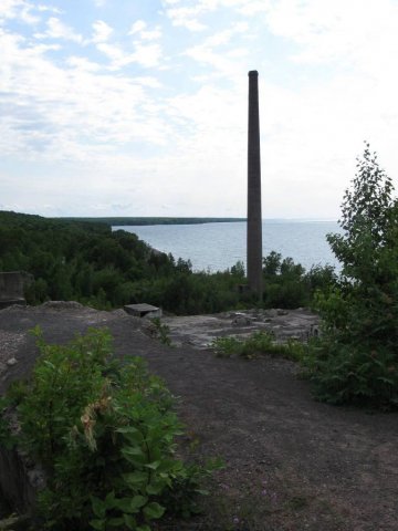
I rode into Red Bluff Stopping to take a pic of a canyon just north of the road. Once there I checked out what there was to see in town and spent a while just enjoying the nice city park on the bank of the Sacramento River, watching the boats being launched and the people out doing their thing.
When I went to check the Motel Bob (my friend) had just arrived and was going to park his bike. I joined him, unloaded my gear into the room and proceeded to enjoy the first hot shower fo a couple of days, a more than welcome experience. Bob ordered some Thai fod for dinner and then went for a swim while I rested and enjoyed the A/C. Did I mention it was very hot in Red Bluff that day?
The next morning after reloading our bikes I went for a breakfast sandwich while Bob ran by the Kawi Dealer as he was having a small issue he want them to look at. Then we headed out of town on 36 west bound. Just out of town there was a sign that showed that twisty arrow and said next 120 miles. I didn't see it but Bob went back to snap a picture. I tried to find it but maybe later.
Just before Mad River on 36 there s a Forest road (Forest 1) that cuts across the mountain ridge for miles then winds it's way down to Hwy 299 that runs to the Trinity River and Inter sects with Hwy 96 that follows the river north, so did we at least to Happy Camp where we stopped for a refreshment then took another cut off road called Indian Creek to US 199. We camped for that night at an RV park in Cave Junction.
Next morning we separated for the day as I was going to run up 199 to I-5
and on into Eugene to spend as much time as I could with another friend, Bob was still taking the back roads (thus his forum handle "backroadsbob'

that way and rejoined us for dinner and the night at my friends home.
Bob left the next morning to see some other friends in the Eugene area and my friend and I went for a drive east of her house to a couple of lakes and more forest.
Too soon when visiting friends you don't see often enough, the time came for me to get back on the road.
I took Oregon 126 west to US 101 and the Oregon coast north. While passing through Waldport I passed a friend that was planning on joining us in Washington as he was on his way home for lunch and we had a brief chat before I headed on north.
Up 101 a ways I came to hwy 18 that folows the Salmon River a ways then goes on to Portland. Terrible road with horrible traffic and way too many stoplights. Never again. Portland was a mess of traffic snarls trying to get across town on the freeways. I eventually made it onto I-84 eastbound to The Dalles where I crossed the Columbia River into Washington. There I turned west again along the north side of the Columbia where I found a nice County park with a campground right on the rivers edge.
In the morning I continued west to Portland again and back into Oregon to come into Astoria on US 26 from the south and catch 101 again so I could cross that big bridge and causeway across the mouth of the Columbia River.
Once back into Washington I followed 101 on into Forks, Washington and found the campground called Cycle Camp where I was greeted by the host and found a friend (Dave) from Long Beach, Ca. there ahead of me setting up his tent. Him and I were the first and only arrivals that day but others began to arrive on Friday. Dave and I rode out to the beach at La Push Wa. on Friday and then back to forks for lunch before returning to Camp to watch the others trickle in. By nightfall there were quite a few.
Saturday after breakfast a small group of us rode out north to Cape Flattery which is the North western most point in the contiguous United States. It was a bit of a challenge for me to make the walk along the trail to the end and back but it was well worth the effort. A very dramatic scenery area.
Back to camp for Dinner and beers around a roaring camp fire then bedded down for the night.
Sunday morning after breakfast we all went about packing our gear for the rides home said our Good-byes and started our individual and group treks home.
More to come.
Pics
https://picasaweb.google.com/plumbertom1/WCGT3
Sunday I headed north to continue along 101 around the Olympic Peninsula and back as it turned south. I didn't follow it to the end at I-5, instead I took the road to Bainbridge Island and rode the ferry across the Puget Sound into Seattle then south on I-5 to Fife where I stopped at another friends house only to find him not at home. Entirely my fault if only because My cell was not working and I had no way to tell him when I was coming.
So I headed on to the east from there through Enumclaw along Hwy 410 and found a quiet campground just before Mt. Rainier National Park. I bedded down for the night.
Monday morning I rode into the park and took the road up to Sunrise. No better place to view the glaciers and snow cap on Rainier in my opinion. Plenty of alpine flowers blooming in the warm sunny day on the road to Sunrise, just a gorgeous ride up and back.
Leaving the park I traveled east on US 12 to Yakima then south on US 97 to I-84 eastbound again. Getting off at the Heppner Junction of Or. 74 which I folloed through Heppner and on east to US 395 and turned south toward home once again. Made camp for the night at a state campground just south of Ukiah, Or.
Southbound on 395 in the morning was an experience in itself. There would be very long stretches of road where I wouldn't see any other vehicles in either direction.
The real adventure came after I went past Riley and the gas station there. My map showed a couple more towns along 395 south so as I had more than 1/2 tank of fuel I didn't stop. thus I entered the Great Basin. When I came to the next Gas stop I discovered it was out of business, well there was another place up the road withing range so on I went, but it was abandoned also. Now my map says it a long damn way to the next town but it shows a lake called Abert between where I was and that town so I'm thinking maybe there will be a resort or something with gas. I get there and it apears to be an alkaline or salt lake with no thing around it but more rocks. Not long after that the low fuel light comes on. Now, I've been riding really conservative like across this desert, doing between 55 and 60 all the way so I figure maybe I make it another 20 miles on the low fuel light. But I came to a town called Valley Falls about 10 miles further down the road and there at the junction of 395 and Or. 31 there is a gas station and store! I pull up to the pump stop and get off only tpo notice they have diesel and regular, no problem. I don't like to run regular but in a pinch one gallon to get me to the next town, which shows to be bigger on my map, will do. Then I notice the pump has a padlock I turn to the store and the door is locked. It's 33:00PM for crying out loud and this obviously a operating store. Ican see itwell stocked and lighted inside. Then I see this little sign in the window that says " Don't bother knocking, I won't answer. If you need emergency gas, Call (phone number) and Tom will come for a $10 service charge".
Remember I said my cell wasn't working?
So here I am, I can see the sign that says 20 miles to the next burg and I know there is no way I can make that when a truck pulls up to the station. The driver asks me if the store is open which I answered for him. I noticed this Ford Diesel is not only towing a good sized camp trailer but, most important to me, it has a quad in the bed. I asked the driver if they might be carrying extra fuel for the quad and explained my situation. Sure enough they had a can with a couple gallons in it and poured me about half of that into my tank. Then they refused to take my money.
Thanks Guys, you give hunters a good name when you help like that.
So I made it to Lakeview, Or. and found plenty of gas waiting for me there.
395 carried me further south into California and I was begining to feel more at home. I stopped in Alturas for a burger then on to a litlle town called Adin where I found a RV park. As I pulled in the manager was out walking around and I asked him about a tent space. He told me he didn't have one but I could camp for free in the town Park. I said thanks but that I had been riding for a couple of day and desperately needed a shower. He then said "Well I have this little grass picnic area over there so you go set up there and you can camp and have a shower for $5." It was a nice little area with trees and grass right next to the laundry/shower building and the shower was great.
The next morning he came out to see me off and point me to a little place for coffee and breakfast after I declined his offer to make me coffee. I did have the stuff to make my own coffee but wanted a bite to eat also.
I went where he directed me and they had great coffee but didn't have breakfast. Even so the owner/cook offered to make me Eggs bacon and hash browns with toast. I told him thanks but I'd be okay with a BLT and tots with my coffee so he wouldn't have to go off his regular menu.
Then back south on the side road (139) that paralleled 395 if 30 miles offand up in the mountains. it rejoned 395 and headed into Nevada through Reno and Carson City then back to Ca. at Topaz Lake where I had a pretty good steak, eggs, and hash browns with toast for about $4 at the Topaz Lounge and Casino coffee shop.
Then further down 395 past Mono lake to Lee Vining and Hwy 120 through the Tioga pass entrance to Yosemite. almost 90 iles through the park to Hwy 41 and another stop at my sisters for an overnight stay.
Next morning I got back on 41 south then turned off east through the foothills north of Fresburg to back road past Pine Flat Res. across to Hwy 180 and a ride through Sequoia and Knigs Canyon National parks. Then south out of the parks to Viasalia And Hwy 99 south to I-5 and on into L.A. and home.
Total miles, 4007, total days 17. What a ride. would have gone further but my budget was running low.